Words —
Eleanor Hughes
Alice Springs Telegraph Station, built in the early 1870s, helped connect Australia with the world. From here, the eastern trailhead of Northern Territory’s 223km Larapinta Trail, which traverses the West MacDonnell Ranges – or Tjoritja as the traditional Arrernte owners know them – I will connect with country and culture.
Along red dirt trails scattered with white quartz and rust-coloured rocks, our two guides point out bush tomatoes, the apple bush’s apple-scented purple flowers, and silvery-grey mulga trees – their ash used for paint by Aboriginal people, wood for spears, ground seeds and flowers for flour – and the witchetty tree, its roots home to witchetty grubs, a staple of Indigenous diet.
An ascending, rust-coloured rock trail leads to Euro Ridge, according to legend the spine of a wallaroo. Far below, grey-green country, distant white clusters marking Alice Springs’ suburbs, is hemmed by ranges. Wide horizontal stripes of red and green along their faces make them look painted. It’s a vast, watercolour-like landscape.
The day ends at World Expeditions’ award-winning, semi-permanent eco-camp, one of three we’ll stay in over six days. Solar lighting, showers – hot water in a bucket with a shower rose at its base – sofas, kitchen and dining area below an awning resembling rolling hills, large tents with stretchers and canvas swags… Add in three-course meals and only having to hike with a daypack, it’s certainly a comfort tour.
Brodie, from Kungkas Can Cook, a local Indigenous food business, presents bush tucker. Cut open, brown, woody, tennis-ball-sized bush coconuts, made by scale insects, reveal white, bitter flesh and a large larvae. I decline the larvae. Acacia and wattle seeds ground into dukkah, red quandong fruit made into jam, bush tomato chutney, and kangaroo meat are all delicious.
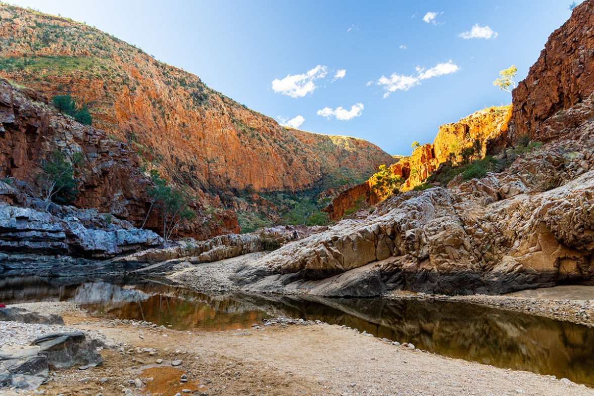
Walking through grassland, four emus cross our path the next morning. An upside-down river, water running below the sand, leads to Simpson’s Gap. White sandy banks contrast against towering orange, black and red schist-like cliffs that taper to a V-shaped gap. Greenish water runs between, the cloudless blue sky above; two black rock-wallabies spring amongst black boulders.
At Standley Chasm, William, an Aboriginal guide, points out bat-leaved coral trees, lemongrass for cooking, river red gum which provides wood for bowls and tools, and ancient MacDonnell Ranges cycads. A dry stream bed weaves past orange rock faces to reach soaring red cliffs, which cast shadow over the narrow gap between them. White boulders clutter the chasm end, beyond a motionless, clear waterhole. To traditional owners it’s called Angkerle Atwatye –“this place where water moves between”.
Later, William explains skin names – Aboriginal kinship systems which determine who people may marry or even speak to. It’s complex.
On the valley floor, golden sand, shaded by red gums, surrounds shimmering waterholes.
Morning in Serpentine Gorge is cool, only the upper cliff faces flame with colour where the sun hits. White-barked gums stud the dry rock bed weaving snake-like between them. Thought to be home to a fierce water serpent, people only came here to drink from the shallow waterhole if desperate. A breeze ripples its surface; silence broken only by chirping zebra finches.
My heart thumps on a 700m climb over 3km through landscape dotted with spiky grey-green spinifex, and red, purple and yellow-flowered native shrubs which provide bush tucker and medicine. Southwards, the striped range is backdropped by golden dune-like hills. Far below, a parched valley is bordered by the jagged Chewing Range, resembling a giant breaking wave from 1,170m-high Counts Point. Distant Mt Sonder peaks, Larapinta’s official end; faraway Gosse Bluff, a comet crater, rises like Uluru. In this infinite landscape, a tiny dot of a car travels an indistinguishable highway.
Inarlanga Pass is a ceremonial place for Western Arrernte people; a meeting point for traders, and the boundary between different communities’ lands. Clambering over rocks into the pass, I shiver, the sun yet to rise above the orange rock faces where layers curve snake-like, pushed up and buckled over millions of years.
Benjamin, a local Aboriginal guide, leads us to the Ochre Pits. Red, white and yellow ochre swirl across the 10m-high cliff faces. Used in ceremonies for generations, the ochre is important in Dreamtime (creation) stories, one of which tells of seven sisters dancing across the land, forming valleys and mountains.
At 3.15am, we’re a line of bobbing glowworms hiking through black nothingness, ascending Mt Sonder. The sky turns light purple, clouds darken; we summit as the sun blazes the horizon. Streaking sky and clouds orange, it reveals a landscape of shadowy peaks, Gosse Bluff, and a pale green valley hemmed by tilted multi-hued ranges.
Ascending sparsely treed hills, I look over Ormiston Pound, a 46.5-sq-km mountain-bound enclosure from which Aboriginal people apparently herded kangaroos into Ormiston Gorge. On the valley floor, golden sand, shaded by red gums, surrounds shimmering waterholes. We walk between towering pink, orange and purple rock faces; schist-like blocks of rock look like they may fall at any moment. Ascending to Ghost Gum Lookout, where white-barked gums stand, I look over this stunning landscape. Our final day. I have connected with country and culture.
Eleanor travelled courtesy of World Expeditions.
worldexpeditions.co.nz/australia